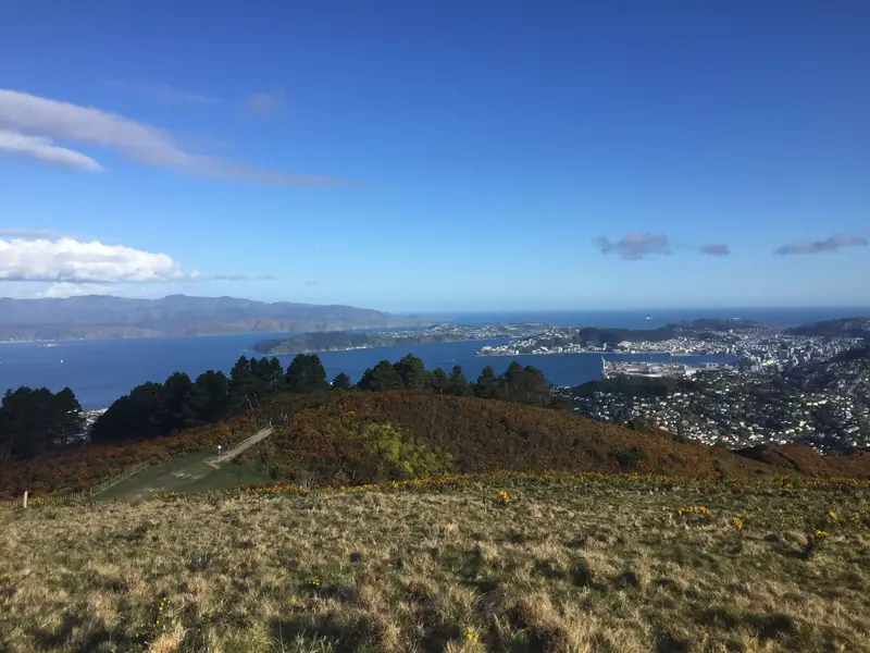
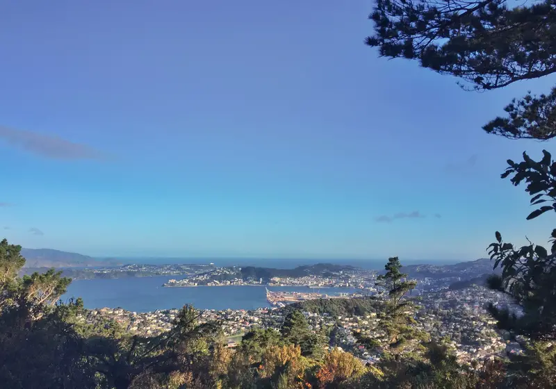
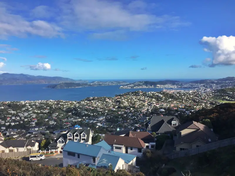
The Mount Kaukau walk is less than 8km from the Wellington CBD and is a solid way to spend a couple hours on a nice afternoon. From the summit, there are panoramic views over Wellington CBD, Wellington Harbour, Rimutaka Ranges, the northern suburbs, and on a clear day a glimpse of the South Island.
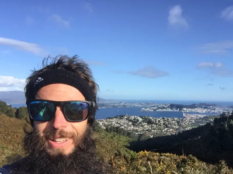
At the Mount Kaukau peak in September 2018 (after a 10km run)
This post will cover:
- My Mt Kaukau walk experience with various tips and comments
- How to get to the trail head
- A quick FAQ about the walk
- A bunch of photos
It’s not a long walk, with four access points that take you straight to the summit making is a worthwhile place to visit in Wellington. You can see the peak from the city (look for the TV tower to the northwest. I can’t believe it took me 30 years to hike up.
The summit is somewhere between 420 metres and 445 metres above sea level depending on what source you use. Depending on the route you take, you’ll walk between 3.5 an 5km total.
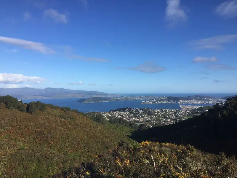
Sneak peak of the CBD on the way up
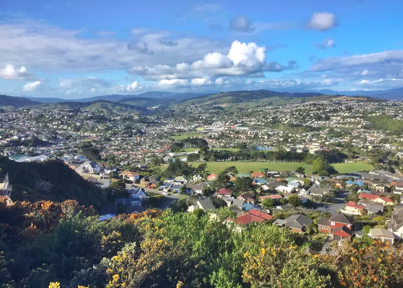
The northern suburbs from somewhere on the ascent
I entered from the Sirsi Terrace entrance, walking up Old Coach Road in Broadmeadows to the summit (~123 metres in elevation gain). This is not the ideal way I would take which I’ll talk about below.
The tracks are wide with wicked views of the harbour and suburbs behind you as you roll through the gullies (was stoked to see some koru which I hadn’t seen in years). The total distance to the summit ~1.5km (you can see the lookout early on), and took me about 25 minutes with a couple minutes spent chatting to fellow walkers. There’s a couple of points where you have the option to take the steep route or easier route, go the steep route (it’s not that steep). And no, you won’t get lost.
Haven’t seen one of these for a while!
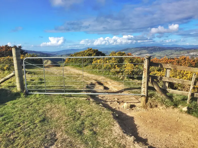
There is this one gate you might need to jump over/under coming from Sirsi Tce
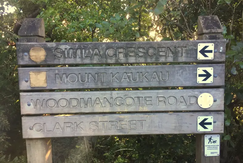
Well worn signage!
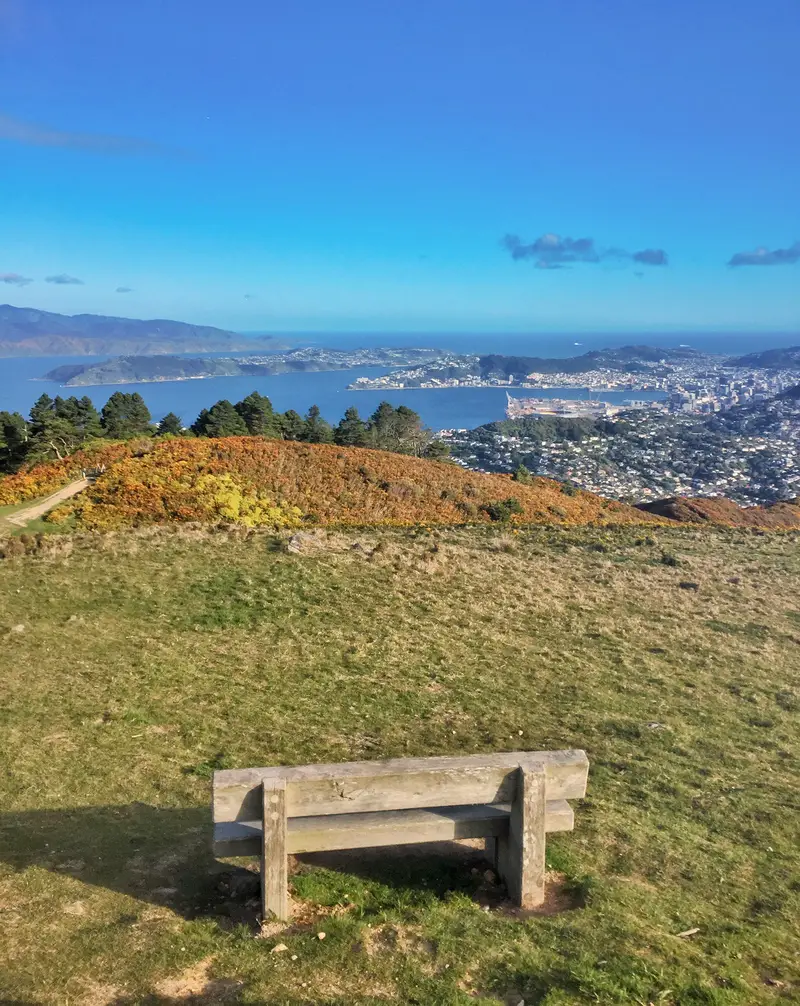
At the summit you’ve got a large flat open area with a few benches and the lookout. In the middle of the lookout is a map/compass thing that shows you what you’re looking at in different directions which is cool. There are a few benches around, but other than that it’s pretty simple. Oh, and you’ll see the 122-metre TV tower nearby too. Enjoy the views for as long as you like, and proceed back down whichever track you wish.
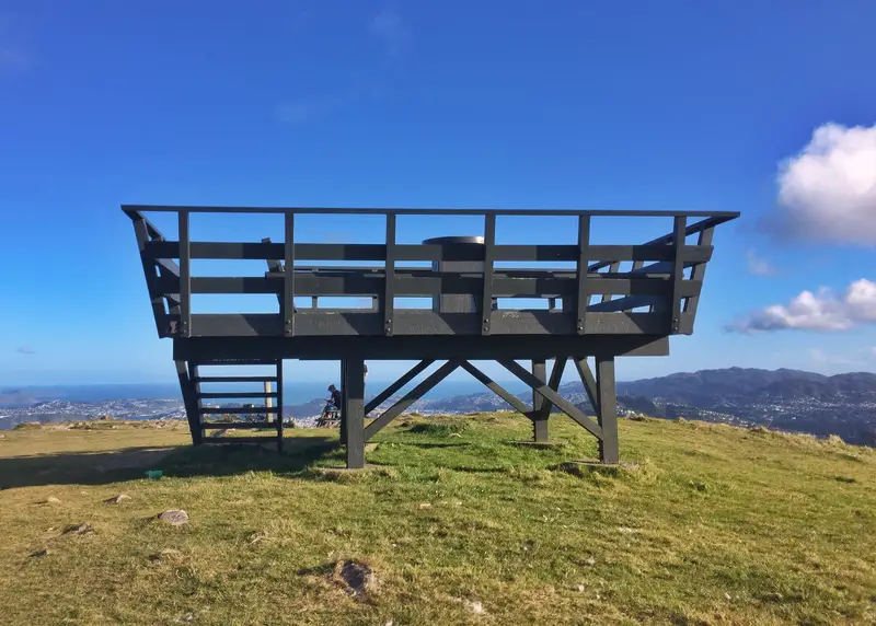
The lookout, you can’t miss it
You can’t beat Wellington on a good day.
Hey there good looking
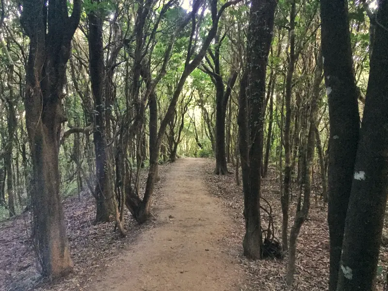
I went down the track leading to the Simla Crescent entrance in Khandallah (~285 metres of descent). The descent was in total contrast to the ascent. Coming down involved a cruisey (unexpected) walk through a forest the majority of the way with only a couple of brief views of the harbour. There were a bunch of different turnoffs you could take, but there are enough signs to help out.
The descent took about 30 minutes at an easy pace. The reason the elevation change is so different on this route is due to incline in the streets leading up to the Sirsi Terrace trailhead.
One of the quick views on the way down.
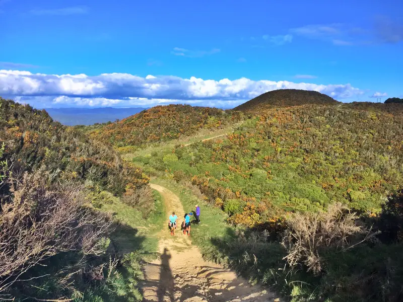
On the way up. Nice big tracks, right!
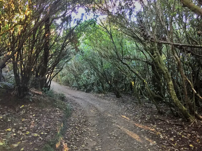
A few forest photos from the descent coming, now.
The best direction to walk Mount Kaukau is:
Entering from either Simla Crescent (public transport) or Woodmancote Road (driving) and hiking to the summit, and descending towards Sirsi Terrace. But, rather than walking through the suburbs to your starting point you should cut back across towards the bottom of the hill and you’ll get back to your entry point quicker (Simla or Woodmancote). The point at where you cut back is just before you hit the sealed road that takes you to Simla Crescent.
It’s hard to describe, but if you download Maps.me, this is the Mt Kaukau loop track I recommend. You starting at the bottom of the image and go in a clockwise direction. That loop is 4.3km long and you’ll be back to the start point in 90 minutes (the Woodmancote entrance is close to the Simla entrance).
I recommend going this way as the hike up to the summit is under trees most of the way. Coming down will be easier in the open and you can take in all the views as you go.
Mount Kaukau Walk FAQ etc.
The view just 2 minutes after starting the walk from Sirsi Terrace, chooooice
How do I get to the Mount Kaukau trailhead?
You can get there by car or public transport. For the ambitious, you could walk from the CBD.
Drive: The best place for parking is on Woodmancote Terrace in Khandallah which is right by the trailhead. There should be plenty of parking as the Khandallah Pool and Cafe du Parc is next to the carpark. If not, you might be able to snag on the handful of spaces on Simla Crescent. If you’re still out of luck (on a sunny weekend you may struggle), you’ll have to drive around and find something a little bit further away, be sure to check the parking rules.
Public Transport: The best way to get here is via train. From Wellington Station you can catch the Johnsonville Line train to Simla Crescent Station (15 minutes) where it’s only a 3-minute walk to the trailhead. If you’re paying cash an adult ticket is $5.00 and a child ticket $2.50 (one way). You can see the timetable here.
Are dogs &/or bikes allowed on the track?
Dogs are allowed, but must be leashed. You’ll likely come across some mountain bikers on the summit, but they’ll be coming from the Skyline track direction and shouldn’t pose any trouble for you.
Is there a track map available?
You don’t need a map. The signs along the way are more than enough, and if need be, they’re all detailed on Maps.me as mentioned earlier.
How long does it take to walk the trail?
I would suggest you plan to spend 1.5 hours from the time you reach the trailhead, to the time you exit the track. Add transit time as necessary.
Is the walk safe?
Safe as houses. Nothing to worry about for this one.
Best time of the day to walk?
This is an easy one, mid-late afternoon. From the Mount Kaukau peak, you’re looking southeast towards the city, so the sun sets behind you if you’re looking at the city. I was there right before the shadows starting to swallow the city, and that was 1.5 hours before sunset. In Wellington as soon as the sun does go down behind the hills the temperature can drop fast!
Is it worth it?
If you’re in Wellington for a day or two, you’d be better off spent going up the more touristy Mount Victoria Lookout. But if you want a longer hike, you could do the Northern Walkway and Skywalk which includes the peak of Mount Kaukau along the way.
In saying that, the reviews for this are great: 4.8/5 on Google Maps, and 4.5 on TripAdvisor.
Have fun heading up to Mt. Kaukau. As always, happy to help with any questions you may have.
MORE WELLINGTON WALKS:

LOL on that gate jump Jub. We hiked a gorgeous little park a few miles south of Opotiki. Name escapes me. Anyway, at one point we had to open and close an electric fence, ensuring we secured all sheep that may or may not be in the area. Public place. Quite funny and flat out entertaining to me as I am so used to stricter laws on trespassing and such in the States.
haha that’s awesome! Hope you didn’t piss on the fence :p Used to be a silly thing we did growing up…
It’s cool how the farmers are so cooperative, I wonder if they get any cash as I can’t imagine there are any other benefits for them to open it up?