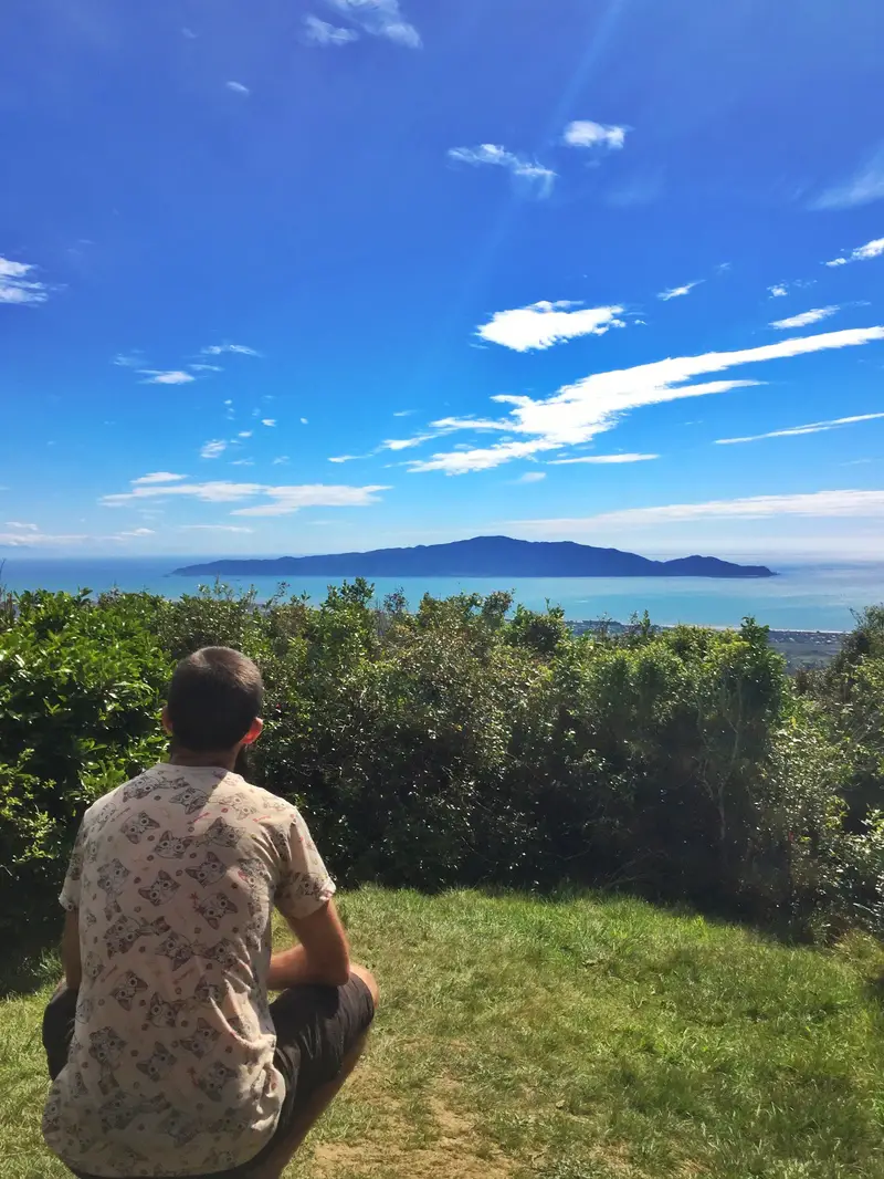
The 330-hectare Hemi Matenga Scenic Reserve borders the east of Waikanae. With the summit 514 metres above sea level, it’s no beast height wise but the summit views of Kapiti Island are epic.

One of my favourite views!
There are three trails you can walk take through the scenic reserve:
- The Kohekohe Walk
- The Parata Track
- The Te Au Route
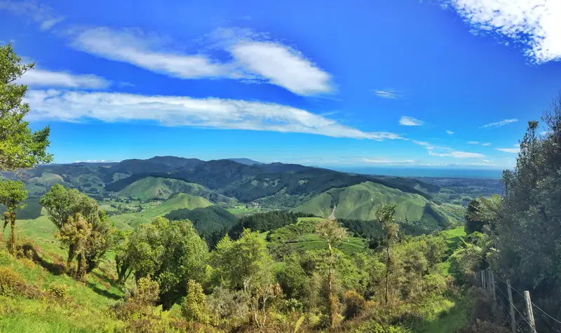
Looking southwest-ish from the Parata Track Lookout
In this post you’ll read about:
- My experience and thoughts on each of the tracks
- Photos from the track (scroll to the end of the post for all photos)
- A Hemi Matenga walk FAQ
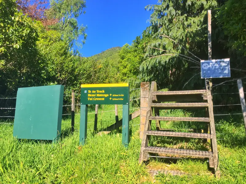
Note: I departed all the walks from the Tui Crescent entrance. You can start the Te Au track from Huia Street (good for the knees), and the Kohekohe Loop from Kakariki Grove.
Note 2: If you’re not familiar with hiking, check out this post on what to wear hiking for ideas on what to wear/pack etc.
1. The Kohekohe Walk
The Kohekohe Walk
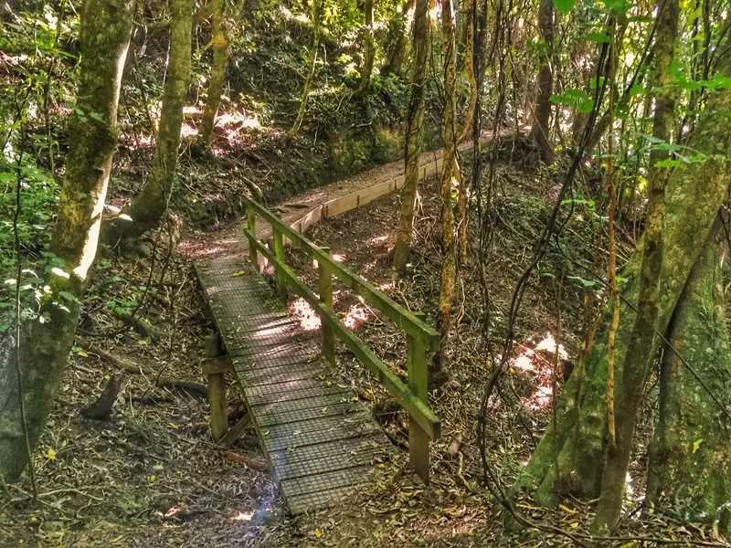
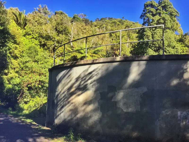
This 1.1.km track is short and sweet and will take no more than 30 minutes to complete (15 minutes is realistic). You start the Kohekohe Track as you would the Parata & Te Au from Tui Crescent by following the track next to the stream beyond the water reservoir. After 330 metres, you’ll come across a yellow signpost where the Parata & Te Au track splits off. The remaining 800 metres is flat with a couple of small inclines on well-formed paths. There’s not a lot to say about this one. The track exits onto Kakariki Grove which is 1.1km from Tui Crescent. There are no epic views along the way, but it’s a nice shaded walk that locals like to do for daily exercise.
2. Parata Walking Track
The view from the Parata Track summit
The Parata Track leads to a lookout with views over farmland to the south, and out west to Kapiti Island and the Kapiti Coast. The distance signs on the track don’t exactly make sense, but it’s ~2km in distance each way with ~350 metres of incline. Suggested time to walk it return is 1-2 hours which is about right for most.
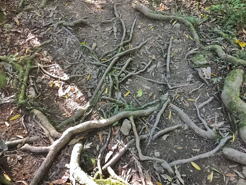
The walk starts out comfortable as part of the Kohekohe Walk, until it splits off at the 330-metre mark. The trail isn’t marked but that’s alright, it’s super easy to follow. There are a couple of points where it looks like the track splits off, but they always meet up again.
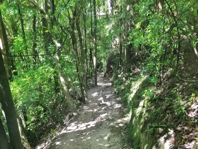
After the easy start, the incline will start to kick in and the route is monotonous. The trees, shrubs, and if you’re lucky bird life (I saw parakeets and a tui) is classic New Zealand. The first time you get a view of Kapiti Island is when you get to the lookout. The incline is never drastic, but if you’re moving at a good pace you’ll find yourself getting sweaty.
You’re under the tree canopy the entire way, and you’ll know when you get to the finish of the Parata Track when there’s a clearing. To your right, you’ll see Kapiti Island peaking through. If you’re short you may not get a clear view of the island. There’s an area where you can sit on the bank to take a rest, or continue walking until you reach the bench with the signs for the Te Au and Parata tracks (below). That’s only another minute or so. From here, you’ll have views looking south along the coast and farmland.
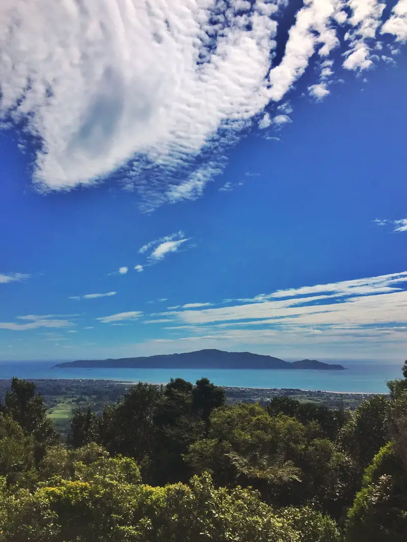
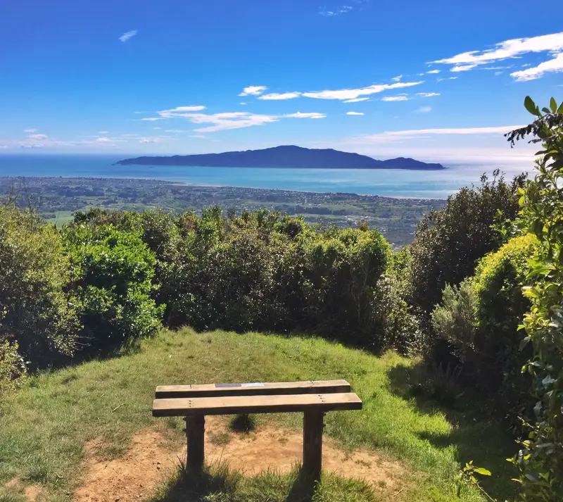
While you could turn back having reached the end of the Parata Track, I’d recommend walking another 15 minutes or so along the Te Au track to the next lookout which has my favourite view of Kapiti Island. There’s a bench for you to take it all in too (the trees in front of the bench are starting to hinder the view!)
Te Au Track
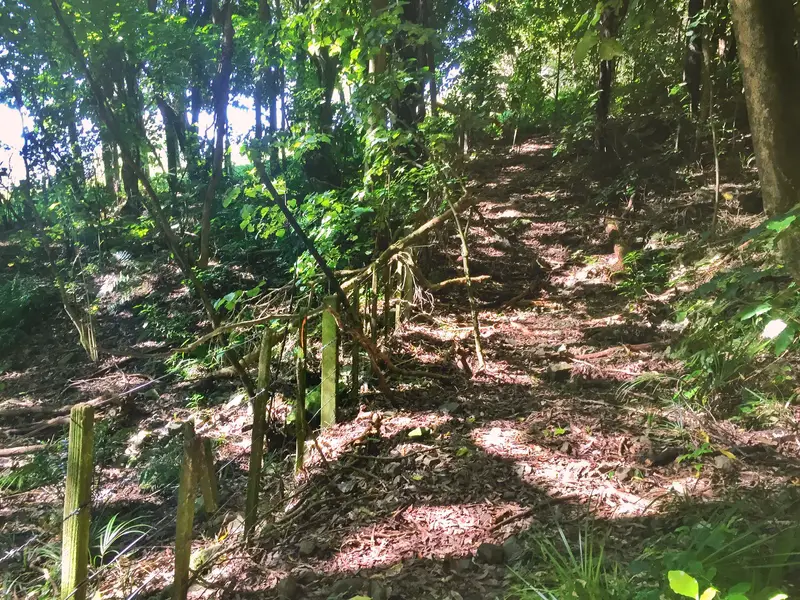
The Te Au Track gets more ruthless
The Te Au Track includes the Parata Trac, so I’ll continue on from the Parata Walk lookout, which if you continue is the Te Au Track.
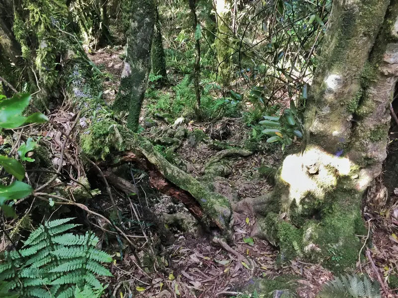
As you leave the Parata Track behind, you’ll start to see orange triangles nailed to trees, these are the Te Au walkway markings. DON’T to follow the pink triangles, that’s poison (I believe). You’ll be following a fence line for a few hundred metres to start with. As soon as the track leaves the fence line the track is more rugged. You can make out the path easy enough, but it’s not as simple as it was. After 15 minutes or so you’ll come across a fork, and if you turn left and walk 10 metres you’ll reach my favourite lookout. You can see why.
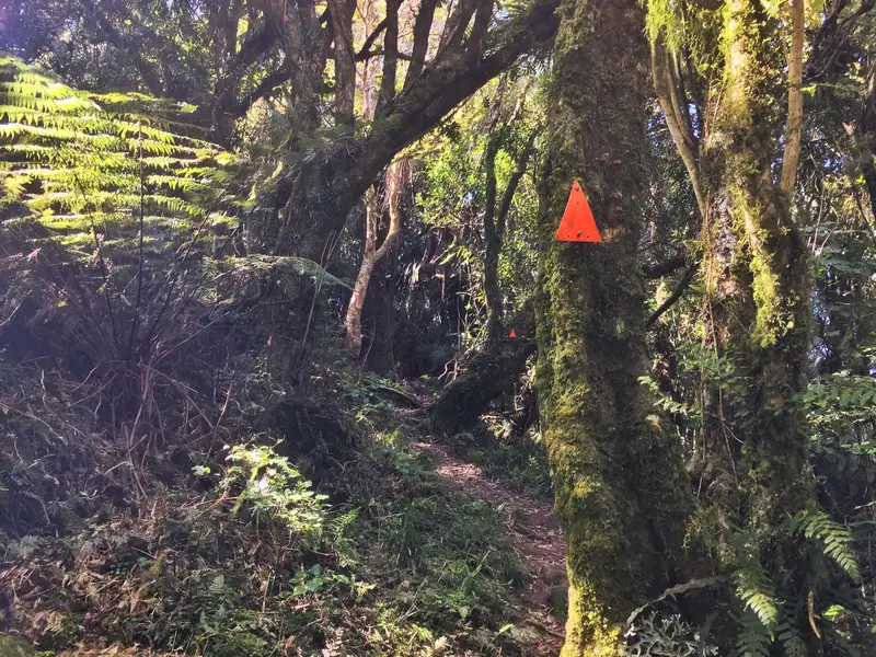
These are the orange markers to trace the Te Au Track
If you’ve got dodgy knees, this is the point at which you turn back as the decline gets pretty steep in spots compared to the Parata track. FWIW it’s better to start the Te Au Track at Huia Crescent if you have dodgy knees.
After admiring all the views, it’s time to go back to the fork and go in the other direction where you follow the ridgeline before descending. The track continues to get more wild, though again, it’s still easy enough to make out and follow (the orange markers have got your back). You’ll be stepping over lots more roots, shrubs, and branches from now on.
Now, the descent is bad for the knees, but it’s not impossible. There are trail runners who will go this way and if they can manage not to injure themselves, you’ll be okay. If you think you’re getting off track turn back to where you came from and look for the orange markers, they’re frequent enough that you won’t have any issues.
Once the descent starts, it’s time to focus, especially after rainfall. As you’ve experienced on the entire walk thus far you’ll be under the canopy of the forest.
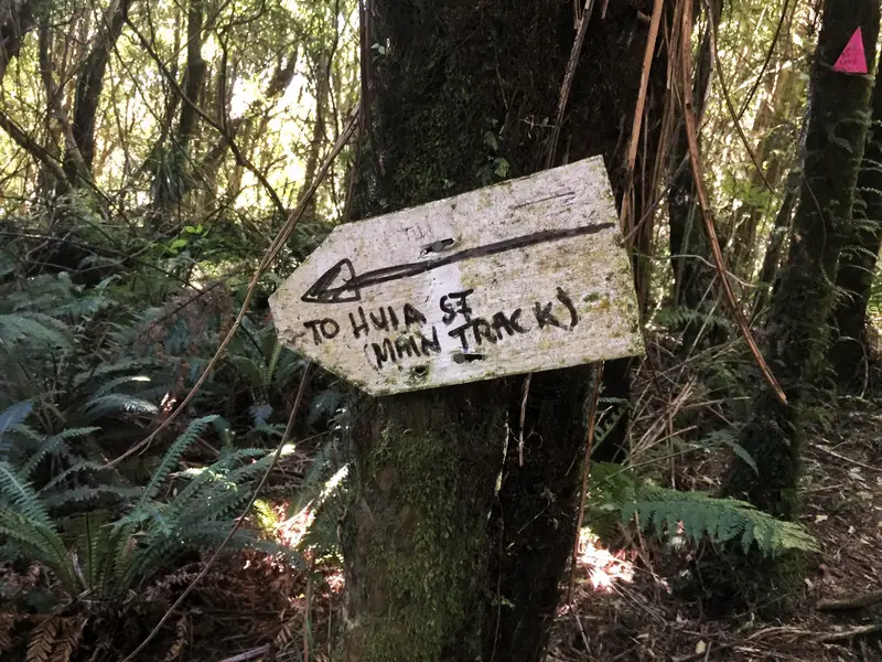
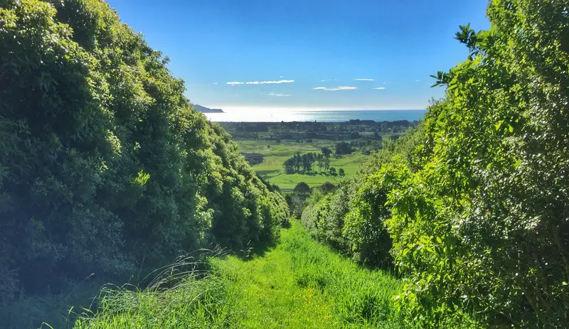
The descent comes to an abrupt end and if you’re like me, you’ll reach the fence line and be a bit confused about where the trail is. If you do this, backtrack ~30 metres back, and you’ll see the orange markers start heading right whereas the pink markers continue straight towards the fence line (took me a few minutes to figure out). From here, you’ve got a couple of minutes of flat terrain to the entrance before going down the grassy trail between two properties to Huia Street.
It was 2 hours and 50 minutes for me to start from Tui Crescent to reach Huia Crescent at the other end. The signs suggest 3-4 hours which is reasonable given I took a 15 minute break at the lookout and chatted to a fellow hiker for 5 minutes or so.
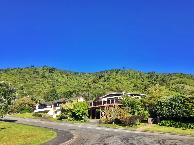
Looking up at Hemi Matenga on the way back to Tui Crescent
If you need to get back to Tui Crescent (1.8km walk):
- turn left onto Huia Street
- take the first left onto Amokura Street
- turn right onto Winara Ave
- take the second left onto Kaka Street
- turn right onto Kotare Street
- turn left onto Tui Crescent
To get into Waikanae Village from there, turn left on Huia Street, turn right onto Ruru Street, left onto Seddon Street and continue walking until you reach Elizabeth Street.
Hemi Matenga FAQ
The Lookout on the Te Au Track (15 minutes beyond the Parata Summit)
How to get to Tui Crescent:
Driving: There is car parking space available on the street next to the entrance.
Public transport: Catch the train to Waikanae Train Station. From here, it’s a 10-15 minute walk to the Tui Crescent trail head.
Are dogs allowed?
Yes, but they should be on a leash as there is poison on the tracks for predators.
Is there a map available?
There’s no physical map I’m aware of, but this brochure might help you.
Is It Safe?
The Tararua Ranges which are further inland than the Hemi Matenga Scenic Reserve has claimed plenty of lives. Hemi Matenga? You shouldn’t have any issues (bar injury). I did find my phone reception on the Te Au track was weak/out of range a lot, so play it safe and let someone know if you’re walking the trail and when you’ll be back by. Otherwise, the only other danger is the weather which you should be considering anyhow.
I grew up in Waikanae (less than an hour north of Wellington) with Hemi Matenga looking over me. It’s a walk I always enjoy as THAT VIEWPOINT is always epic (thanks for helping there Kapiti Island). If you have any questions, I’m happy to help however I can.
MORE WELLINGTON WALKS:


What a hike Jub.
I was treated to aka spoiled with that view of Kapiti Island daily in Paeka. We were 1 block from the beach with a sea view. What a magical area.
I walk the Te Au and Parata Tracks most weekends, and I almost always ascend via the Te Au Track and descend via the Parata Track, which is the reverse of the route described here. That way I go up the steepest parts instead of down them.
Hey Darryl,
That’s interesting! But I can see the reasoning, lots of people hate going down…especially on the steep sections 😮
Thanks for sharing your experience.
Jub
Thanks for the info