The Tirohanga Track is a short (~3.2km) end to end walk with easy access from the centre of Picton. It’s the perfect walk if you’ve got a couple of hours before catching your ferry or plan on spending a couple days in Picton.

From the top of the Tirohanga Track
This post will cover:
- My Tirohanga Walk experience
- A quick walk FAQ
I had no intentions on completing the Tirohanga Track after arriving in Picton on the Bluebridge. The walk came into my life when told of the shit weather in Kaikoura, whereas it was a calm day in Picton. Queue, the Tirohanga Track!
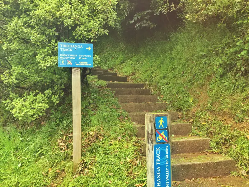
The Newgate end trailhead
The Newgate Street trailhead was a short walk away and I ate my scoop of chips on the way there (Loved Kiwi Takeaways!. You start climbing right away, the first 20 metres or so is as steep as the track gets.
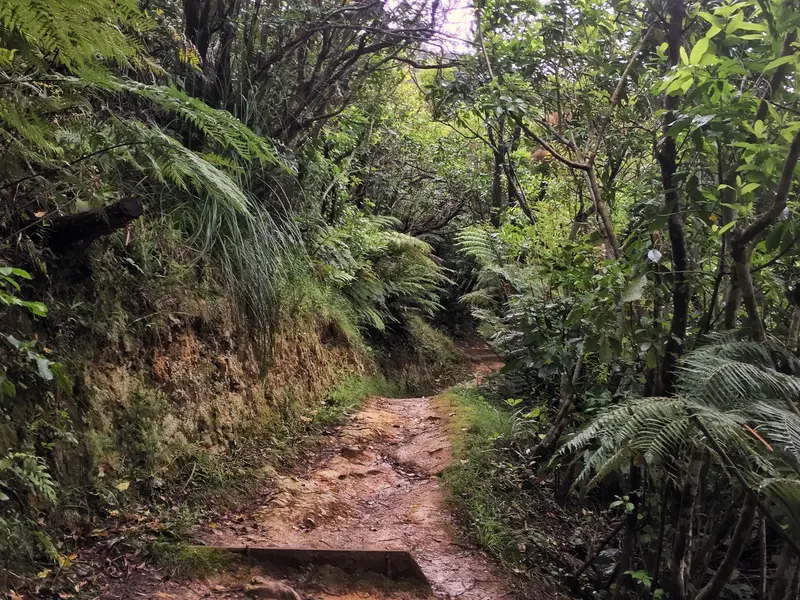
I was carrying my two bags with me and was feeling the heat so switch out the jeans for shorts. You’re under a canopy of trees most of the way to the summit with lots of switchbacks making the walk a lot less steep than it could otherwise be. You do see some views through the bushes a couple of times
Straight into it, eh.
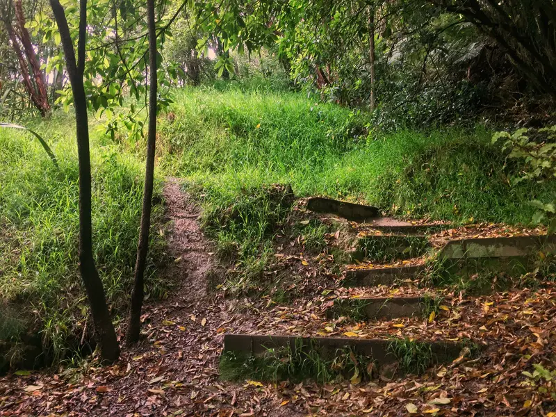
This is what the trail looks like most of the way
Note: I’m basing the distances below off Maps.me and feel they’re accurate.
The sign at the trailhead says the hike to the summit will take 45 minutes, which is accurate (40 minutes for me). When you get near the peak, the canopy of trees gives way and you’ll find the viewpoint from the first photo. The view in the other direction is of farmland and mountains, nice, but not as great as the other view. At this point, you’ll have walked around 2km with ~220 metres of elevation.
You could return the way you came, but you may as well continue on walking along the track to the other end. It’s a shorter distance to the end of the trail at around 1.2km and took me about 22 minutes to reach the bridge at the bottom of the trail. This trailhead is in a more rural setting, and you’ll see the B&B nearby.
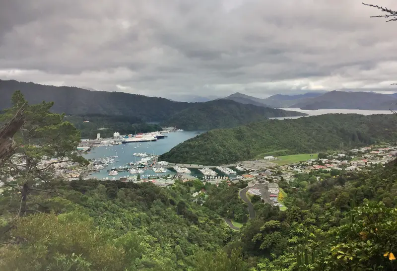
The view from the top
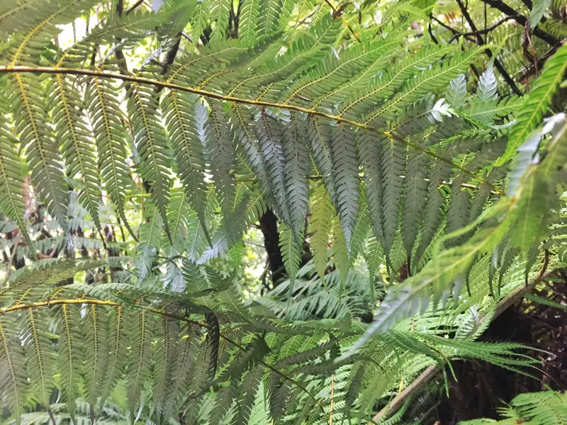
A silver fern spot on the trail
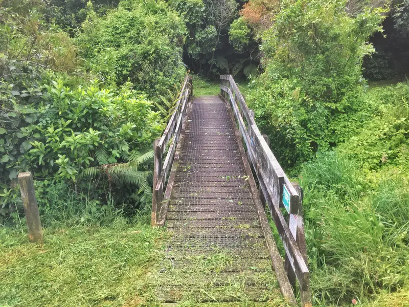
The Bridge at the Garden Terrace trailhead you cross to start/finish the hike
After the bridge there’s a sign pointing towards the stepping stones or the bridge. The stepping stones could be fun if you think you’re agile enough to not fall in the river. There were a couple stepping stones submerged when I was there, so took the bridge route. Both routes lead to Garden Terrace which leads you back into town.
If I was to leave the hostel I stayed in (Fat Cod – I recommend) and started the clock watch while completing the hike and stop the watched when walking back in the hostel, the total time would be less than two hours.
Considering I wasn’t planning on staying in Picton, this was a nifty little walk. If you’ve got some time (2+ hours) to kill before catching the ferry to Wellington, do it!
Tirohanga Track FAQ
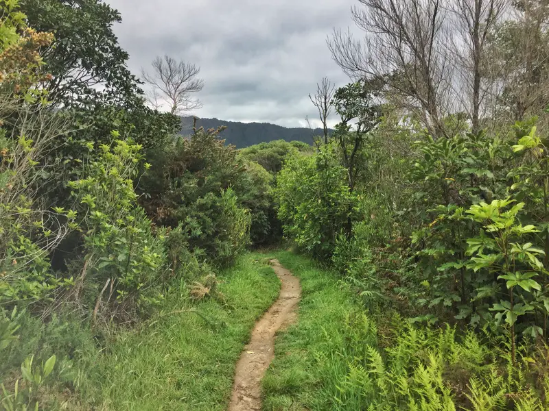
The trail opens up towards the top
How do I get to the Tirohanga Track trailheads?
The walk is a short distance from Picton town centre (if you have a car you should be able to park by the Newgate entrance otherwise park in the city). One entrance is along Newgate Street, about 200 metres on the right-hand side (Google Maps link).
The other entrance is by Essons Valley Homestay B&B. You’ll see a short bridge which you cross to start from the southern end of the track.
Is there a better end to start at?
It doesn’t matter, but I would go with the Newgate Street as it’s easier to find.
Are dogs &/or bikes allowed on the track?
Dogs are and need to be on a leash at all times. Bikes are not allowed on the Tirohanga Track.
Is there a track map available?
You don’t need a map. The signs along the way are more than enough, and if need be, they’re all detailed on Maps.me.
How long does it take to walk the trail?
From end to end it took me about an hour. The suggested time is 90 minutes, which is plenty for 90% of people. Add in some walking time to get to and from the Picton town centre.
Is the walk safe?
Yup, there’s no steep sections along the side of the track, nor any major landslip threat. A few switchbacks on the way to the summit from the New.
Best time of the day to walk?
Whenever! As I mentioned earlier, it’s a great walk to do if you want a short manageable adventure before catching the ferry.
Is it worth it?
I’d never come to Picton for the Tirohanga walk alone, but given its proximity to the ferry it’s worth it if you have the time. And if you’re planning to spend time in Picton, it’s definitely worth doing if the longer walk on the Snout Track doesn’t work for you.
This walk rates as a 4.7/5 and 4.5 on Google Maps and TripAdvisor respectively.
If you’ve got any questions about the Tirohanga Track let me know! (scroll on down for photos)
READ NEXT: